Tre Cime di Lavaredo Hike Guide: How to Get There, Loop Trail & Photo Tips
Complete Tre Cime di Lavaredo guide: how to reach Rifugio Auronzo, the toll road cost, the 10 km loop hike, best time to visit, drone rules, and photography tips for the Dolomites' three peaks.
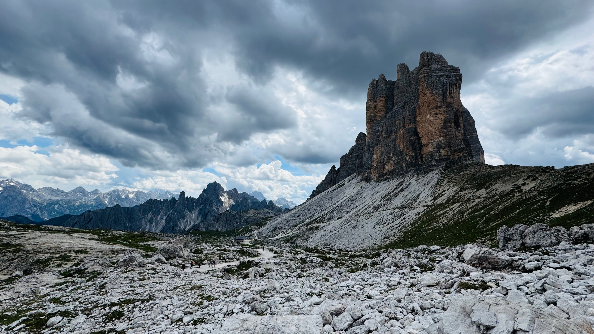
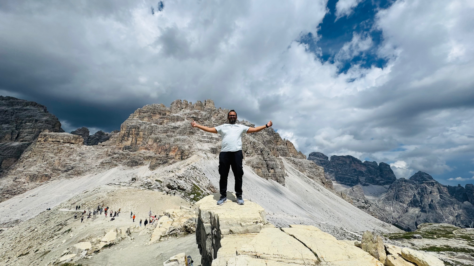
The Tre Cime di Lavaredo — three near-vertical limestone towers punching out of the ridgeline of the eastern Dolomites — are the picture most people have in their head when they think of the Italian Alps. In real life they're bigger, stranger, and easier to reach than the photos suggest. I spent a day up at 2,400 m walking the loop with a shifting wall of cloud coming off the peaks, and it's the most cinematic weather I've ever shot in Europe.
Where is Tre Cime di Lavaredo?
The Tre Cime sit inside the Parco Naturale Tre Cime in the province of South Tyrol, right on the border between the Italian-speaking Veneto and the German-speaking Alto Adige. The trailhead is at Rifugio Auronzo (2,320 m), reached by a paid mountain road that climbs from the valley near Misurina. If you're pinning it on Maps, search "Tre Cime di Lavaredo" — the pin lands on the massif itself; you actually drive to Rifugio Auronzo.
How to get to Tre Cime di Lavaredo
Nearest airports to the Dolomites
- Venice Marco Polo (VCE) — ~2h 30m drive. The most common starting point.
- Treviso (TSF) — ~2h 15m. Good for low-cost carriers.
- Innsbruck (INN) — ~2h 30m over the Brenner from the north.
Rifugio Auronzo toll road and parking
From either Cortina d'Ampezzo (~40 minutes) or Dobbiaco/Toblach (~30 minutes) you'll take the SR48 to Misurina and then turn onto the Rifugio Auronzo toll road. This is where most day-trippers get caught out:
- Toll: roughly €30 per car in high season (cash and card accepted at the booth). It's non-negotiable and it's steep, but it's what keeps the top of the mountain from being a chaos of parked cars.
- Timing: arrive at the booth before 8am in July and August or you'll queue for an hour, and the upper car park can fill entirely by 10am. On busy weekends the road is closed to new cars once the lot is full.
- No car? Buses (Cortina Express and Dolomiti Bus, line 30/31) run from Cortina and Dobbiaco directly to Rifugio Auronzo in summer. Check schedules the day before — service is seasonal.
The Tre Cime loop hike: distance, time & route
The circuit around the three peaks is the reason people come here. It's the rarest kind of alpine trail: enormous scenery, minimal elevation gain, and genuinely accessible to anyone in reasonable shape.
- Distance: ~10 km loop.
- Time: 3.5–4.5 hours at a photo-stopping pace.
- Elevation: only ~400 m of cumulative gain — you start high.
- Difficulty: moderate. Well-marked paths 101 and 105. Some exposed ridgeline but no scrambling.
Go counter-clockwise from Rifugio Auronzo. The route: Auronzo → Rifugio Lavaredo → Forcella Lavaredo → Rifugio Locatelli (Dreizinnenhütte) → back around the western side. The postcard view — the three north faces lined up in a row — is from the terrace at Rifugio Locatelli, roughly halfway. That's where you eat lunch and where you'll linger.
Best time to visit Tre Cime di Lavaredo
- Late June – early October: the toll road and rifugi are open. Outside these dates the road is closed by snow.
- July – August: peak season. Warmest weather, longest days, maximum crowds. Arrive at dawn or don't bother.
- September: the sweet spot. Fewer people, cooler light, and often a first dusting of snow on the peaks. This is when I'd go back.
- Winter: the road is closed. You can ski-tour or snowshoe in from Misurina, but it's a full mountaineering day, not a casual trip.
Drone rules in the Tre Cime natural park
The Tre Cime are inside a designated natural park, and recreational drone flight without a specific park permit is prohibited. That's not an EASA rule — it's an Italian protected-area rule that sits on top of EASA. Signage at the trailhead is unambiguous. If you're serious about aerial work here, apply for the permit through the park authority weeks in advance and carry the paperwork on you.
For the EU-wide framework and how the Open Category actually works in practice, my EASA Open Category guide covers the pilot side.
Photography tips for Tre Cime di Lavaredo
- Shoot storm light, not blue sky. The Tre Cime look two-dimensional in flat sunshine. Broken cloud, storm build-up, or a passing weather front is what makes the north faces feel like sculpture.
- Golden hour is on the north faces at sunset in mid-summer, because the sun swings that far north. Stay for it — most day-trippers are gone by 5pm.
- Long lens from Locatelli. A 70–200 compresses the three peaks into a single wall. A wide angle from below (24–35mm) gives you scale with the foreground scree.
- The Cadini di Misurina viewpoint is a 20-minute detour from the loop on the way back — a serrated ridge of pinnacles that photograph almost as well as the Tre Cime themselves.
What to pack for the Tre Cime hike
- Proper hiking boots (some scree, some exposed rock).
- Layers and a windproof shell — the ridge is exposed and 10°C colder than the car park.
- 2 L of water minimum; refill at the rifugi.
- Sun protection: you're at 2,400 m, UV is aggressive even in cloud.
- Cash (euros) for the rifugi — card acceptance is patchy up here.
- A headlamp if you're staying for sunset and walking back to the car park.
Where to stay near Tre Cime di Lavaredo
- Cortina d'Ampezzo — the upscale base. Great food, great bars, expensive rooms. Best if you're combining Tre Cime with Cinque Torri, Lago di Braies, and Passo Giau over several days.
- Dobbiaco / Toblach — quieter, more affordable, and marginally closer to the toll road. German-speaking side of the border, so expect Tyrolean food.
- Sleep on the mountain. Rifugio Auronzo and Rifugio Locatelli both take overnight guests. Book months in advance for summer. The reward is having the loop entirely to yourself at sunrise, before the toll booth opens.
Is Tre Cime di Lavaredo worth it?
The Tre Cime deliver on the hype — but only if you treat them like a mountain and not like a viewpoint. Get there early, walk the full loop, stay for weather instead of running from it, and respect the park rules on drones and off-trail wandering. On a good day it's the single most cinematic short hike in Europe.
Planning a Dolomites shoot? My Eibsee guide covers a similar early-arrival strategy in the Bavarian Alps, and the contact page is the fastest way to reach me for licensing or commissioned mountain coverage.